Abstract
Sustainable agriculture and smart horticulture are essential for ensuring food security under increasing climate variability, resource constraints, soil degradation, and biological stresses. Among these challenges, weed infestation remains a major cause of yield loss, reduced crop quality, increased production costs, and excessive herbicide use. Effective and timely detection of crop stress and weed pressure is therefore critical for improving productivity while minimizing environmental impacts. This study presents a remote sensing-enabled framework for resilient horticultural management that integrates unmanned aerial vehicles (UAVs), RGB and multispectral imagery, vegetation indices, artificial intelligence, and field observations to support precision decision-making. High-resolution UAV data acquired throughout the growing season are used to derive spectral and image-based indicators, including harmonized indices, canopy cover, texture features, and thermal metrics. These indicators are combined with ground-based measurements, soil information, crop phenology, and yield data to characterize crop vigor, detect stress conditions, and identify weed-infested areas. The proposed framework enables the generation of weed distribution maps, crop health zones, stress severity assessments, and site-specific management recommendations. Potential applications include targeted weed control, precision irrigation, optimized nutrient management, and variable-rate field interventions. By integrating advanced remote sensing technologies with ecological practices such as integrated weed management, mulching, cover cropping, and soil health enhancement, the framework promotes a transition from conventional uniform management to data-driven precision horticulture. The study highlights the potential of combining remote sensing and intelligent analytics to improve resource-use efficiency, reduce chemical inputs, enhance crop productivity, and strengthen the resilience of horticultural systems. Such approaches offer a practical pathway toward sustainable and climate-smart agriculture.
Biography
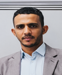
Dr. Ahmad received his Ph.D. in Photogrammetry and Remote Sensing from the State Key Laboratory of Information Engineering in Surveying, Mapping and Remote Sensing (LIESMARS), Wuhan University, Wuhan, China, in 2024. He obtained his M.Sc. degree in Earth System Science from the Institute of Space and Earth Information Science, The Chinese University of Hong Kong, Hong Kong, China, in 2017.